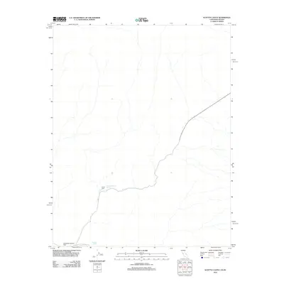
2012 Map of Scottys Castle
USGS Topo · Published 2012About this map
Scottys Castle stands as the central landmark on this arid landscape within Death Valley National Park. Located near the California and Nevada border, the site is defined by its relationship to vital desert water sources, including Scottys Grapevine Spring and Surprise Springs. The road network is sparse, centered on N Hwy and Route 267, which navigate the elevation changes through Grapevine Canyon Pass. This 2012 survey illustrates the isolation of the northern Mojave, where human settlement is restricted to the specific topographic corridor that supports the historic castle and its surrounding springs.
Find a feature on this map
7 named features on this map. Tap any name to fly to it.
Don’t see what you’re looking for? This feature index may not catch every label — zoom into the map to look around manually.
Map Details
Editions of this 2012 Scottys Castle Map
This is the sole edition of this map. No revisions or reprints were ever made.
Other maps of this area

1908 · Lida
USGS Topo · 1:250,000

1908 · Ballarat
USGS Topo · 1:250,000

1913 · Lida
USGS Topo · 1:250,000

1913 · Ballarat
USGS Topo · 1:250,000

1948 · Death Valley
USGS Topo · 1:250,000

1954 · Death Valley
USGS Topo · 1:250,000

1954 · Goldfield
USGS Topo · 1:250,000

1955 · Goldfield
USGS Topo · 1:250,000

1956 · Death Valley
USGS Topo · 1:250,000

1957 · Death Valley
USGS Topo · 1:250,000