1975 Map of Scraggly Lake NE
USGS Topo · Published 1980About this map
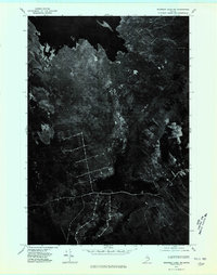
Baskahegan Lake and the meandering Baskahegan Stream dominate this northern Washington County landscape as it appeared in the mid-1970s. This orthophotoquad, derived from 1975 aerial photography, provides a distinct visual record of the shoreline and the surrounding timberlands before modern reforestation cycles and development. The image reveals a complex network of logging roads and clearings that grid the dense woods, illustrating the region's industrial forestry footprint during this era. Unlike traditional topographic maps, this photographic perspective captures the exact texture of the vegetation and the literal path of the water as it moves south from the lake, offering a precise moment in the environmental history of the Maine woods.
Find a feature on this map
2 named features on this map. Tap any name to fly to it.
Don’t see what you’re looking for? This feature index may not catch every label — zoom into the map to look around manually.
Map Details
Editions of this 1975 Scraggly Lake NE Map
This is the sole edition of this map. No revisions or reprints were ever made.
Other maps of this area

1940 · Danforth
USGS Topo · 1:62,500

1940 · Waite
USGS Topo · 1:62,500

1940 · Forest
USGS Topo · 1:62,500

1941 · Danforth
USGS Topo · 1:62,500

1941 · Scraggly Lake
USGS Topo · 1:62,500

1942 · Waite
USGS Topo · 1:62,500

1942 · Forest
USGS Topo · 1:62,500

1943 · Danforth
USGS Topo · 1:62,500

1944 · Scraggly Lake
USGS Topo · 1:62,500

1957 · Fredericton
USGS Topo · 1:250,000