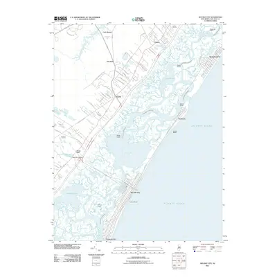
2011 Map of Sea Isle City
USGS Topo · Published 2011About this map
Sea Isle City and the barrier islands of Cape May County are defined by a complex network of marshes, sounds, and inlets along the Atlantic Ocean. This map illustrates the relationship between mainland settlements like Seaville and Palermo and the coastal resort communities connected by the Intracoastal Waterway. The landscape is dominated by tidal waters, including Ludlam Bay and Townsend Sound, which isolate various islands such as Sedge Island and Gull Island.
Find a feature on this map
80 named features on this map. Tap any name to fly to it.
Don’t see what you’re looking for? This feature index may not catch every label — zoom into the map to look around manually.
Map Details
Editions of this 2011 Sea Isle City Map
This is the sole edition of this map. No revisions or reprints were ever made.
Other maps of this area

1884 · Sea Isle
USGS Topo · 1:62,500

1888 · Dennisville
USGS Topo · 1:62,500

1888 · Sea Isle
USGS Topo · 1:62,500

1890 · Great Egg Harbor
USGS Topo · 1:62,500

1890 · Tuckahoe
USGS Topo · 1:62,500

1893 · Great Egg Harbor
USGS Topo · 1:62,500

1893 · Tuckahoe
USGS Topo · 1:62,500

1894 · Dennisville
USGS Topo · 1:62,500

1894 · Sea Isle
USGS Topo · 1:62,500

1918 · Great Egg Harbor
USGS Topo · 1:62,500