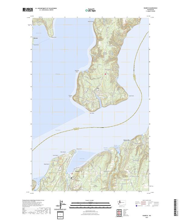
2023 Map of Seabeck
USGS Topo · Published 2023About this map
Toandos Peninsula and the Great Peninsula converge where Dabob Bay meets the main reach of the Hood Canal, defining a landscape deeply tied to the Puget Sound waterfront. This modern data reflects the contemporary layout of several coastal communities, from the small residential pockets at Maple Beach and Scenic Beach to the established settlement at Seabeck. The map provides specific locations for genealogical research, such as the Seabeck Cem located south of Seabeck Bay.
Find a feature on this map
87 named features on this map. Tap any name to fly to it.
Don’t see what you’re looking for? This feature index may not catch every label — zoom into the map to look around manually.
Map Details
Editions of this 2023 Seabeck Map
This is the sole edition of this map. No revisions or reprints were ever made.
Other maps of this area

1936 · Point Misery
USGS Topo · 1:62,500

1937 · Port Orchard
USGS Topo · 1:62,500

1937 · Port Gamble
USGS Topo · 1:62,500

1940 · Port Gamble
USGS Topo · 1:62,500

1940 · Point Misery
USGS Topo · 1:62,500

1940 · Quilcene
USGS Topo · 1:62,500

1953 · Seabeck
USGS Topo · 1:24,000

1953 · Poulsbo
USGS Topo · 1:24,000

1953 · Quilcene
USGS Topo · 1:24,000

1953 · Mt. Walker
USGS Topo · 1:24,000