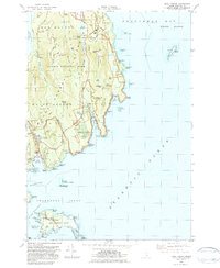
1983 Map of Seal Harbor
USGS Topo · Published 1983About this map
Acadia National Park dominates this coastal survey, where the granite peaks of the Maine coast meet the Atlantic Ocean. The landscape is defined by the high elevations of Cadillac Mountain, Dorr Mtn, and Pemetic Mtn, which drop sharply toward the sea at Otter Cliff and Schooner Head. Cultural landmarks like the Museum and Sieur de Monts Spring illustrate the early development of the park's interior, while the Park Loop Road provides a view of the intricate coastline, including the famous Thunder Hole and Sand Beach. To the south, the seafaring character of the Cranberry Isles is evident in the settlement of Islesford and the remote Sutton Island. The map preserves the specific 1980s configuration of local infrastructure, including the Blackwoods Campground and the village of Seal Harbor with its historic St Judes Ch.
Find a feature on this map
91 named features on this map. Tap any name to fly to it.
Don’t see what you’re looking for? This feature index may not catch every label — zoom into the map to look around manually.
Map Details
Editions of this 1983 Seal Harbor Map
2 editions found
Other maps of this area

1904 · Mount Desert
USGS Topo · 1:62,500

1904 · Swan Island
USGS Topo · 1:62,500

1904 · Bar Harbor
USGS Topo · 1:62,500

1942 · Bar Harbor
USGS Topo · 1:62,500

1942 · Mount Desert
USGS Topo · 1:62,500

1943 · Swans Island
USGS Topo · 1:62,500

1945 · Swans Island
USGS Topo · 1:62,500

1948 · Bangor
USGS Topo · 1:250,000

1956 · Bar Harbor
USGS Topo · 1:62,500

1956 · Mount Desert
USGS Topo · 1:62,500