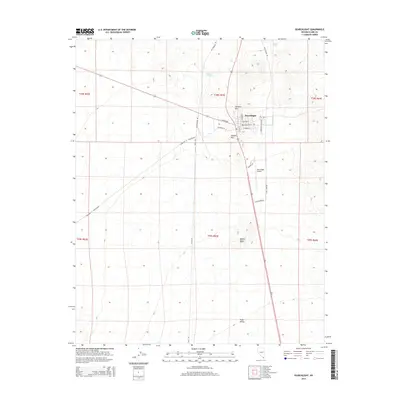
2014 Map of Searchlight
USGS Topo · Published 2014About this map
Searchlight serves as the central hub in this Southern Nevada landscape, where the high desert terrain of the Mojave Desert meets the northern reaches of the Piute Valley. The settlement is defined by a grid of local streets like E Addition St and E Encinatas St, with the Searchlight Airport and Old Airport Rd extending to the south. Water sources, vital in this arid environment, are marked by Dipping Vat Spring and Whisker Spring at higher elevations near Doherty Mtn. The infrastructure of the early 21st century is evident through prominent utilities like the Gas Pipeline Rd and the S Gas Pipeline which cut across the desert floor. To the west, the route of the Barnwell & Searchlight follows the natural draws, while the local geography is punctuated by distinct landmarks such as Duplex Hill.
Find a feature on this map
26 named features on this map. Tap any name to fly to it.
Don’t see what you’re looking for? This feature index may not catch every label — zoom into the map to look around manually.
Map Details
Editions of this 2014 Searchlight Map
This is the sole edition of this map. No revisions or reprints were ever made.
Other maps of this area

1886 · Camp Mohave
USGS Topo · 1:250,000

1892 · Camp Mohave
USGS Topo · 1:250,000

1910 · Ivanpah
USGS Topo · 1:250,000

1912 · Ivanpah
USGS Topo · 1:250,000

1926 · Nelson
USGS Topo · 1:96,000

1926 · Mohave City
USGS Topo · 1:96,000

1942 · Camp Mohave
USGS Topo · 1:250,000

1942 · Ivanpah
USGS Topo · 1:250,000

1947 · Kingman
USGS Topo · 1:250,000

1948 · Kingman
USGS Topo · 1:250,000