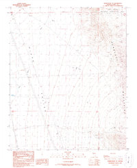
1989 Map of Searchlight SE
USGS Topo · Published 1990About this map
The Newberry Mountains dominate the eastern landscape of this Nevada survey, rising sharply from the broad expanse of the Piute Valley. This late-twentieth-century study shows a rugged region defined by public lands and industrial infrastructure, including a portion of the Lake Mead National Recreation Area in the northeast. Evidence of human activity is scattered throughout the arid terrain, ranging from a remote corral and Sewage Disposal Pond to modern utility markers like a Substation, Radio facility, and numerous power transmission lines.
Find a feature on this map
20 named features on this map. Tap any name to fly to it.
Don’t see what you’re looking for? This feature index may not catch every label — zoom into the map to look around manually.
Map Details
Editions of this 1989 Searchlight SE Map
This is the sole edition of this map. No revisions or reprints were ever made.
Other maps of this area

1886 · Camp Mohave
USGS Topo · 1:250,000

1892 · Camp Mohave
USGS Topo · 1:250,000

1926 · Mohave City
USGS Topo · 1:96,000

1942 · Camp Mohave
USGS Topo · 1:250,000

1947 · Kingman
USGS Topo · 1:250,000

1948 · Kingman
USGS Topo · 1:250,000

1950 · Davis Dam
USGS Topo · 1:62,500

1952 · Davis Dam
USGS Topo · 1:62,500

1954 · Kingman
USGS Topo · 1:250,000

1955 · Kingman
USGS Topo · 1:250,000