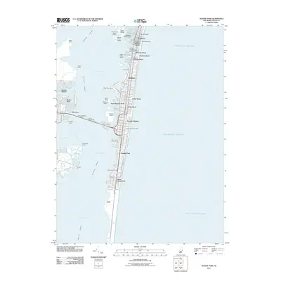
2011 Map of Seaside Park
USGS Topo · Published 2011About this map
Barnegat Bay and the Atlantic Ocean define the geography of this barrier island corridor, where a sequence of shore communities follows the coastline. In the north, Silver Beach, Chadwick, and Monterey Beach sit near the narrowest part of the peninsula, while the more developed borough of Lavallette occupies the central stretch. Connectivity to the mainland at Coates Point is provided by the Thomas A Mathis Bridge and the J Stanley Tunney Bridge, which cross over Pelican Island to reach Seaside Heights. The landscape transitions from the urbanized boardwalk environments of Ortley Beach to the more open terrain toward the southern reaches of Island Beach, offering a clear view of the Intracostal Waterway and various sedge islands such as Middle Sedge and Marsh Elder Island.
Find a feature on this map
42 named features on this map. Tap any name to fly to it.
Don’t see what you’re looking for? This feature index may not catch every label — zoom into the map to look around manually.
Map Details
Editions of this 2011 Seaside Park Map
This is the sole edition of this map. No revisions or reprints were ever made.
Other maps of this area

1888 · Barnegat
USGS Topo · 1:62,500

1888 · Asbury Park
USGS Topo · 1:62,500

1893 · Asbury Park
USGS Topo · 1:62,500

1893 · Barnegat
USGS Topo · 1:62,500

1898 · Barnegat
USGS Topo · 1:62,500

1901 · Asbury Park
USGS Topo · 1:62,500

1902 · Navesink
USGS Topo · 1:125,000

1919 · Barnegat
USGS Topo · 1:62,500

1919 · Asbury Park
USGS Topo · 1:62,500

1941 · Toms River
USGS Topo · 1:62,500