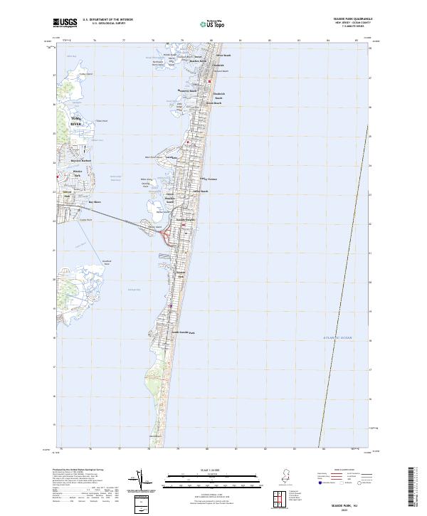
2023 Map of Seaside Park
USGS Topo · Published 2023About this map
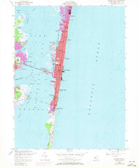
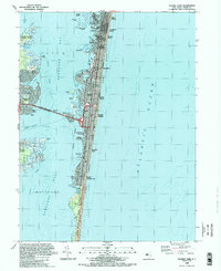
Seaside Heights and its neighboring barrier island communities are depicted in detail as they appeared in 2023, showcasing a dense network of coastal settlements along the Atlantic shore. The geography is defined by the thin strip of land separating the Atlantic Ocean from Barnegat Bay, connected to the mainland via the bridge over Pelican Island. This modern survey illustrates the intensive residential and commercial development of towns like Lavallette and Seaside Park, where a grid of streets such as New Jersey Ave and President Ave reaches right to the shoreline. To the west, the mainland developments of Windor Park and Gilford Park border the wetland preserves of Cattus Island, highlighting the contrast between suburban expansion and the protected marshes and thoroughfares of Silver Bay.
Find a feature on this map
135 named features on this map. Tap any name to fly to it.
Don’t see what you’re looking for? This feature index may not catch every label — zoom into the map to look around manually.
Map Details
Editions of this 2023 Seaside Park Map
This is the sole edition of this map. No revisions or reprints were ever made.
Historical Maps of Ocean County Through Time
3 maps found