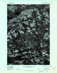
1978 Map of Sebec Lake East
USGS Topo · Published 1981About this map
Sebec Lake dominates the southern edge of this orthophotoquad, revealing the complex, wooded shoreline of Piscataquis County in the late 1970s. The aerial imagery captures a transitional landscape of heavy forest and clearing, where the small settlements of Bowerbank and Barnard are defined more by the surrounding terrain than by dense development. The water system is clearly visible, showing the path of Mill Brook and the drainage through Bear Brook. Unlike a traditional topographic map, this photographic record provides a direct view of the vegetation density and timber patterns of the era, particularly around the distinctive marshy expanse of Long Bog. The image serves as a precise documentation of the Maine woods before modern developments altered the local forest structure.
Find a feature on this map
6 named features on this map. Tap any name to fly to it.
Don’t see what you’re looking for? This feature index may not catch every label — zoom into the map to look around manually.
Map Details
Editions of this 1978 Sebec Lake East Map
This is the sole edition of this map. No revisions or reprints were ever made.
Other maps of this area

1932 · Dover-Foxcroft
USGS Topo · 1:48,000

1933 · Guilford
USGS Topo · 1:62,500

1935 · Dover-Foxcroft
USGS Topo · 1:62,500

1937 · Guilford
USGS Topo · 1:62,500

1940 · Sebec
USGS Topo · 1:48,000

1943 · Sebec
USGS Topo · 1:62,500

1950 · Sebec Lake
USGS Topo · 1:62,500

1954 · Millinocket
USGS Topo · 1:250,000

1958 · Millinocket
USGS Topo · 1:250,000

1960 · Millinocket
USGS Topo · 1:250,000