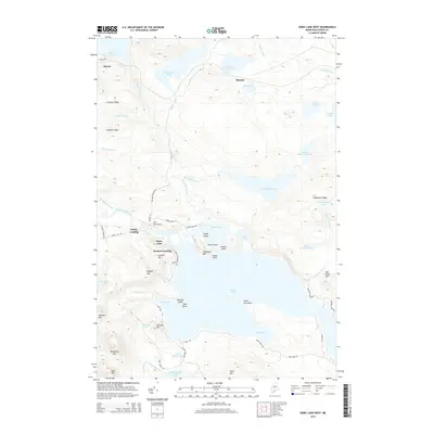
2014 Map of Sebec Lake West
USGS Topo · Published 2014About this map
Sebec Lake dominates this Piscataquis County landscape, where historical water routes and modern aviation meet. The northern reaches are defined by a chain of glacial waters, including Lake Onawa, Big Benson Pond, and the First Buttermilk Pond, all connected by winding drainages like Ship Pond Stream. Small settlements and landings such as Onawa, Earley Landing, and Packard Landing hint at the area's history as a recreational and resource-rich hub. Near the shores of the lake, industrial footprints are visible at the Granite Quarry on the slopes of Granite Mtn. This intersection of rugged terrain and water-based access is further evidenced by the Two Falls Airport, situated near the confluence of Big Wilson Stream and the lake's western edge. The map captures a transition where high peaks like Hampshire Mtn and Ragged Mtn descend toward the bays and points of the Sebec shoreline.
Find a feature on this map
75 named features on this map. Tap any name to fly to it.
Don’t see what you’re looking for? This feature index may not catch every label — zoom into the map to look around manually.
Map Details
Editions of this 2014 Sebec Lake West Map
This is the sole edition of this map. No revisions or reprints were ever made.
Other maps of this area

1932 · Dover-Foxcroft
USGS Topo · 1:48,000

1933 · Guilford
USGS Topo · 1:62,500

1935 · Dover-Foxcroft
USGS Topo · 1:62,500

1937 · Guilford
USGS Topo · 1:62,500

1940 · Sebec
USGS Topo · 1:48,000

1943 · Sebec
USGS Topo · 1:62,500

1950 · Sebec Lake
USGS Topo · 1:62,500

1954 · Millinocket
USGS Topo · 1:250,000

1958 · Millinocket
USGS Topo · 1:250,000

1960 · Millinocket
USGS Topo · 1:250,000