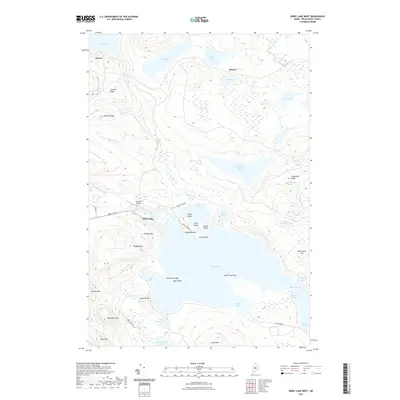
2021 Map of Sebec Lake West
USGS Topo · Published 2021About this map
Sebec Lake dominates the central landscape of this Piscataquis County region, where the water is punctuated by Stork Island, Jordan Island, and Stubb Island. To the north, the small settlements of Onawa and Benson serve as focal points for the upland terrain. The map captures a complex network of seasonal and local routes, including Sebec Lake Rd and Sebec Shore Rd, which provide access to the various coves and points like Deer Point and Green Point.
Find a feature on this map
54 named features on this map. Tap any name to fly to it.
Don’t see what you’re looking for? This feature index may not catch every label — zoom into the map to look around manually.
Map Details
Editions of this 2021 Sebec Lake West Map
This is the sole edition of this map. No revisions or reprints were ever made.
Other maps of this area

1932 · Dover-Foxcroft
USGS Topo · 1:48,000

1933 · Guilford
USGS Topo · 1:62,500

1935 · Dover-Foxcroft
USGS Topo · 1:62,500

1937 · Guilford
USGS Topo · 1:62,500

1940 · Sebec
USGS Topo · 1:48,000

1943 · Sebec
USGS Topo · 1:62,500

1950 · Sebec Lake
USGS Topo · 1:62,500

1954 · Millinocket
USGS Topo · 1:250,000

1958 · Millinocket
USGS Topo · 1:250,000

1960 · Millinocket
USGS Topo · 1:250,000