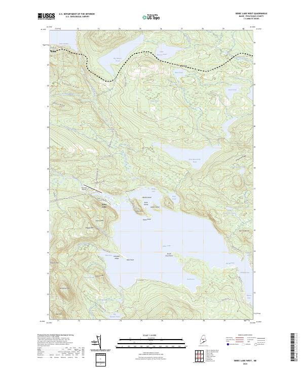
2024 Map of Sebec Lake West
USGS Topo · Published 2024About this map
Sebec Lake and its intricate shoreline dominate this Piscataquis County landscape, where the water is punctuated by Stork Island, Jordan Island, and Stubb Island. The terrain is defined by sharp elevation shifts, including Ragged Mtn and Granite Mtn, which rise steeply above the western reaches of the lake. To the north, the small settlements of Onawa and Benson sit near Lake Onawa and Big Benson Pond, connected by local routes like Onawa Rd. The map illustrates a wilderness characterized by complex water systems, from the cascading Bucks Falls to the narrow passage known simply as The Narrows. Small-scale aviation is represented at Two Falls Airport, while numerous family-named peaks such as Ben Chase Hill and Garcock Hill provide clear markers for local history and geographic study.
Find a feature on this map
72 named features on this map. Tap any name to fly to it.
Don’t see what you’re looking for? This feature index may not catch every label — zoom into the map to look around manually.
Map Details
Editions of this 2024 Sebec Lake West Map
This is the sole edition of this map. No revisions or reprints were ever made.
Other maps of this area

1932 · Dover-Foxcroft
USGS Topo · 1:48,000

1933 · Guilford
USGS Topo · 1:62,500

1935 · Dover-Foxcroft
USGS Topo · 1:62,500

1937 · Guilford
USGS Topo · 1:62,500

1940 · Sebec
USGS Topo · 1:48,000

1943 · Sebec
USGS Topo · 1:62,500

1950 · Sebec Lake
USGS Topo · 1:62,500

1954 · Millinocket
USGS Topo · 1:250,000

1958 · Millinocket
USGS Topo · 1:250,000

1960 · Millinocket
USGS Topo · 1:250,000