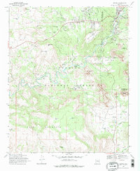
1980 Map of Sedona
USGS Topo · Published 1996About this map
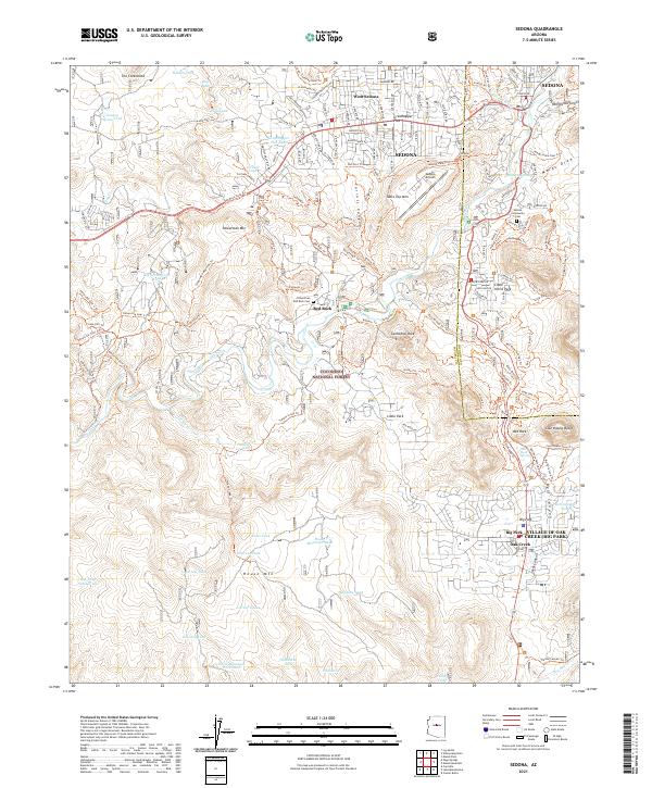
Coconino National Forest and Prescott National Forest dominate this landscape during a period of expanding road access and recreational development. The high desert floor around Sedona gives way to the dramatic topography of Oak Creek Canyon Natural Area and Munds Mountain, while the southern reaches of the map trace the fertile path of the Verde River. Archaeological and indigenous history is central here, with the presence of Montezuma Castle National Monument, including Montezuma Well, alongside the Camp Verde Indian Reservation. The map details the transition from the red rock country to the heavily timbered Mogollon Rim, where features like Blue Ridge Reservoir and Mormon Lake provide critical water resources. Resource extraction and early transport routes are evidenced by the Last Chance Mine and the winding course of Schnebly Hill Road.
Find a feature on this map
87 named features on this map. Tap any name to fly to it.
Don’t see what you’re looking for? This feature index may not catch every label — zoom into the map to look around manually.
Map Details
Editions of this 1980 Sedona Map
This is the sole edition of this map. No revisions or reprints were ever made.
Historical Maps of Cottonwood Through Time
6 maps found