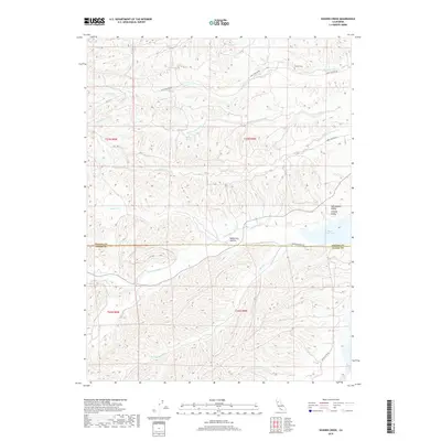
2018 Map of Sehorn Creek
USGS Topo · Published 2018About this map
Elmore Cem sits on a ridge in the northern section of this landscape, overlooking the drainages of Elmore Cr and Sehorn Creek. The terrain is defined by the transition from the upland foothills into the Sacramento Valley, where the waters of N Fork Stony Cr and Burris Cr flow toward the eastern reservoir at Black Butte Lake. The map details a network of rural access routes, including Long Hollow Rd and Morrison Bryan Rd, which navigate the complex topography of Masterson Hollow and various seasonal springs like Jackson Spring. This area straddles the boundary between Tehama and Glenn counties, illustrating the water management and land divisions essential to this part of Northern California during the early twenty-first century.
Find a feature on this map
22 named features on this map. Tap any name to fly to it.
Don’t see what you’re looking for? This feature index may not catch every label — zoom into the map to look around manually.
Map Details
Editions of this 2018 Sehorn Creek Map
This is the sole edition of this map. No revisions or reprints were ever made.
Other maps of this area

1904 · Walker Creek
USGS Topo · 1:31,680

1919 · Fruto
USGS Topo · 1:62,500

1919 · Elk Creek
USGS Topo · 1:62,500

1944 · Fruto
USGS Topo · 1:62,500

1944 · Flournoy
USGS Topo · 1:62,500

1948 · Elk Creek
USGS Topo · 1:62,500
1952 · Fruto NE
USGS Topo · 1:24,000

1952 · Paskenta
USGS Topo · 1:62,500

1957 · Elk Creek
USGS Topo · 1:62,500

1957 · Ukiah
USGS Topo · 1:250,000