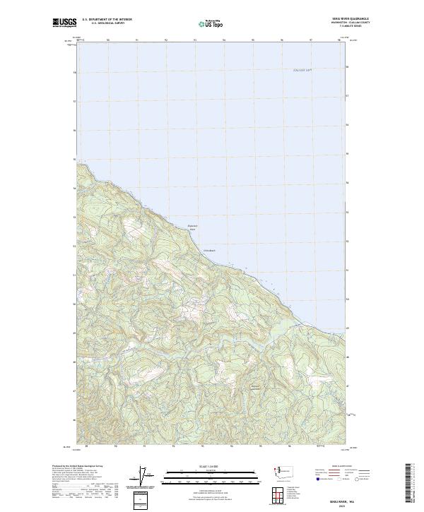
2023 Map of Sekiu River
USGS Topo · Published 2023About this map
The Salish Sea coastline defines this remote corner of the Olympic Peninsula, where the landscape is carved by numerous coastal drainages and the northern foothills of the Olympic Mountains. The Sekiu River serves as the primary hydrological feature, joined by its North Fork and South Fork as it flows toward the strait. Near the shoreline, Shipwreck Point and Chito Beach mark the transition from the timbered uplands to the water's edge. The area is intersected by a network of logging and access routes, most notably the 1000 Main Line Rd and Sekiu River Rd, reflecting the region's long-standing reliance on the timber industry. Numerous smaller waterways like Rasmussen Creek, Jansen Creek, and Olsen Creek cut through the sections, illustrating the complex drainage patterns characteristic of this high-precipitation environment.
Find a feature on this map
18 named features on this map. Tap any name to fly to it.
Don’t see what you’re looking for? This feature index may not catch every label — zoom into the map to look around manually.
Map Details
Editions of this 2023 Sekiu River Map
This is the sole edition of this map. No revisions or reprints were ever made.
Other maps of this area

1935 · Clallam
USGS Topo · 1:62,500

1935 · Ozette Lake
USGS Topo · 1:62,500

1935 · Lake Pleasant
USGS Topo · 1:62,500

1938 · Cape Flattery
USGS Topo · 1:62,500

1942 · Clallam
USGS Topo · 1:62,500

1942 · Ozette Lake
USGS Topo · 1:62,500

1942 · Lake Pleasant
USGS Topo · 1:62,500

1953 · Cape Flattery
USGS Topo · 1:250,000

1956 · Ozette Lake
USGS Topo · 1:62,500

1957 · Lake Pleasant
USGS Topo · 1:62,500