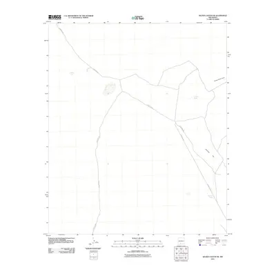
2010 Map of Selden Canyon NE
USGS Topo · Published 2010About this map
Antelope Flat and the drainage of Horse Camp Draw characterize this arid landscape in Doña Ana County. The area is defined by a sparse network of county infrastructure and essential water catchment points, reflecting the ranching requirements of the high desert. Ranchers and land managers in this region relied on vital water features such as Pierce Tank, Lucero Tank, and Beacon Tank to sustain operations across the open range. Navigational access is provided by several primitive routes, including County Rd E077, County Rd E080, and County Rd E088, which represent the primary human imprint on this expansive terrain.
Find a feature on this map
8 named features on this map. Tap any name to fly to it.
Don’t see what you’re looking for? This feature index may not catch every label — zoom into the map to look around manually.
Map Details
Editions of this 2010 Selden Canyon NE Map
This is the sole edition of this map. No revisions or reprints were ever made.
Other maps of this area

1916 · Tonuco
USGS Topo · 1:125,000

1932 · Tonuco
USGS Topo · 1:125,000

1948 · Chicken Well
USGS Topo · 1:62,500

1948 · Bear Peak
USGS Topo · 1:62,500

1948 · San Diego Mountain
USGS Topo · 1:62,500

1948 · Kaylor Mountain
USGS Topo · 1:62,500

1955 · Las Cruces
USGS Topo · 1:250,000

1958 · Las Cruces
USGS Topo · 1:250,000

1981 · Gilmore Draw
USGS Topo · 1:24,000
1981 · Fleck Draw
USGS Topo · 1:24,000