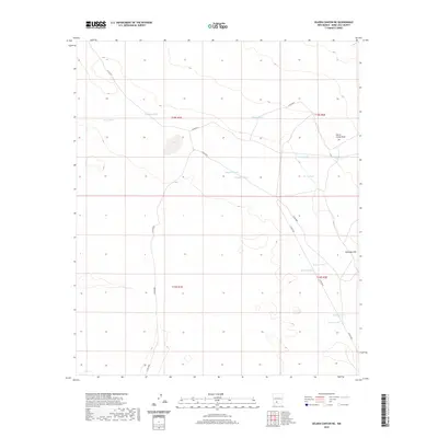
2020 Map of Selden Canyon NE
USGS Topo · Published 2020About this map
Cassady Tank and the drainages of Horse Camp Draw characterize this arid reach of Doña Ana County, where the landscape is defined by its water management infrastructure. The terrain rises toward Antelope Flat in the east, punctuated by a network of essential livestock water sources like Pierce Tank, Powers Tank, and Engholm Tank. The presence of several county roads, including Co RD e077 and Co RD e078, provides a window into the ranching access routes that traverse these township and range divisions. Named features such as Lucero Tank and Lawyer Tank likely reflect the heritage of local families and individuals who worked this desert land, making it a valuable resource for tracing regional land use and genealogical history in the twenty-first century.
Find a feature on this map
22 named features on this map. Tap any name to fly to it.
Don’t see what you’re looking for? This feature index may not catch every label — zoom into the map to look around manually.
Map Details
Editions of this 2020 Selden Canyon NE Map
This is the sole edition of this map. No revisions or reprints were ever made.
Other maps of this area

1916 · Tonuco
USGS Topo · 1:125,000

1932 · Tonuco
USGS Topo · 1:125,000

1948 · Chicken Well
USGS Topo · 1:62,500

1948 · Bear Peak
USGS Topo · 1:62,500

1948 · San Diego Mountain
USGS Topo · 1:62,500

1948 · Kaylor Mountain
USGS Topo · 1:62,500

1955 · Las Cruces
USGS Topo · 1:250,000

1958 · Las Cruces
USGS Topo · 1:250,000

1981 · Gilmore Draw
USGS Topo · 1:24,000
1981 · Fleck Draw
USGS Topo · 1:24,000