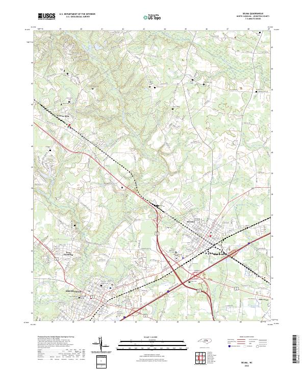
2022 Map of Selma
USGS Topo · Published 2022About this map
The Neuse River corridor defines the geography of this Johnston County region, winding between the burgeoning centers of Smithfield and Selma. This contemporary mapping shows the dense network of family-named cemeteries that anchor the local heritage, including the Grant Cem and Broadwell Cem to the north, and the significant Riverside Cem near the banks of the Neuse. The proximity of West Smithfield and Wilsons Mills illustrates the continued importance of the transportation corridor that parallels the river, connecting historic town centers with educational and civic hubs like Johnston Community College and the Johnston County Courthouse. Smaller water bodies such as Buffalo Cr and Moccasin Cr frame the eastern agricultural landscape near Pine Level, where land patterns maintain their traditional character despite modern infrastructure.
Find a feature on this map
197 named features on this map. Tap any name to fly to it.
Don’t see what you’re looking for? This feature index may not catch every label — zoom into the map to look around manually.
Map Details
Editions of this 2022 Selma Map
This is the sole edition of this map. No revisions or reprints were ever made.
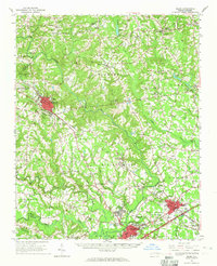
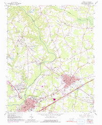
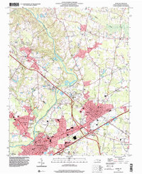
Historical Maps of Fairfield Through Time
4 maps found