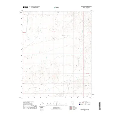
2018 Map of Senator Mountain NE
USGS Topo · Published 2018About this map
The White Hills of Mojave Desert characterize this northern Arizona landscape, where the terrain is defined by a network of drainage washes flowing toward the Colorado River system. Within the Lake Mead National Recreation Area, numerous ephemeral waterways including Temple Wash, Trail Rapids Wash, and Salt Spring Wash carve through the arid topography. These features provide a clear view of the natural drainage patterns in a region where water is the primary architect of the land. In the southeast, the elevation rises toward Golden Rule Peak, while the remote Temple Bar Back Rd provides the primary vehicular access through these desert townships. The map details a transition from open desert flats into the increasingly complex relief of the hills, illustrating the sparse but critical transportation and hydrological markers of this high-desert environment.
Find a feature on this map
14 named features on this map. Tap any name to fly to it.
Don’t see what you’re looking for? This feature index may not catch every label — zoom into the map to look around manually.
Map Details
Editions of this 2018 Senator Mountain NE Map
This is the sole edition of this map. No revisions or reprints were ever made.
Other maps of this area

1886 · Camp Mohave
USGS Topo · 1:250,000

1886 · Saint Thomas
USGS Topo · 1:250,000

1892 · Camp Mohave
USGS Topo · 1:250,000

1893 · Saint Thomas
USGS Topo · 1:250,000

1926 · Bonelli
USGS Topo · 1:96,000

1942 · Camp Mohave
USGS Topo · 1:250,000

1947 · Kingman
USGS Topo · 1:250,000

1948 · Kingman
USGS Topo · 1:250,000

1953 · Iceberg Canyon
USGS Topo · 1:62,500

1953 · Virgin Basin
USGS Topo · 1:62,500