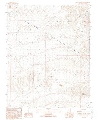
1989 Map of Senator Mountain NE
USGS Topo · Published 1990About this map
The White Hills dominate this portion of the Arizona desert, where mining activity and rugged topography define the landscape within the Lake Mead National Recreation Area. Prospectors and miners left a significant footprint across these slopes, evidenced by numerous prospects, a mine shaft, and an Open Pit Mine located south of Salt Spring Wash. This 1989 revision highlights the persistent search for minerals in the vicinity of Golden Rule Peak, a notable high point in the southern portion of the sheet.
Find a feature on this map
25 named features on this map. Tap any name to fly to it.
Don’t see what you’re looking for? This feature index may not catch every label — zoom into the map to look around manually.
Map Details
Editions of this 1989 Senator Mountain NE Map
This is the sole edition of this map. No revisions or reprints were ever made.
Other maps of this area

1886 · Camp Mohave
USGS Topo · 1:250,000

1886 · Saint Thomas
USGS Topo · 1:250,000

1892 · Camp Mohave
USGS Topo · 1:250,000

1893 · Saint Thomas
USGS Topo · 1:250,000

1926 · Bonelli
USGS Topo · 1:96,000

1942 · Camp Mohave
USGS Topo · 1:250,000

1947 · Kingman
USGS Topo · 1:250,000

1948 · Kingman
USGS Topo · 1:250,000

1953 · Iceberg Canyon
USGS Topo · 1:62,500

1953 · Virgin Basin
USGS Topo · 1:62,500