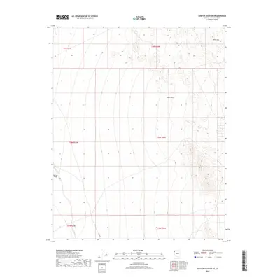
2018 Map of Senator Mountain SW
USGS Topo · Published 2018About this map
Detrital Wash meanders through the southwestern reaches of the White Hills in this 2018 study of the northern Arizona landscape. The terrain is defined by the vast arid expanses of the Mojave Desert, where the elevation changes are marked by the intricate contouring of the foothills. Human presence is sparse, indicated primarily by the network of section lines and isolated corridors like Garden Rd and N First Mead R Mohave Dr. This map illustrates the transition from the low-lying washes to the higher, undulating crests of the White Hills, providing a clear view of the natural drainage patterns and land divisions within the public land survey system. The documentation of these subtle desert features serves as an essential reference for understanding the modern physical geography of the region.
Find a feature on this map
11 named features on this map. Tap any name to fly to it.
Don’t see what you’re looking for? This feature index may not catch every label — zoom into the map to look around manually.
Map Details
Editions of this 2018 Senator Mountain SW Map
This is the sole edition of this map. No revisions or reprints were ever made.
Other maps of this area

1886 · Camp Mohave
USGS Topo · 1:250,000

1892 · Camp Mohave
USGS Topo · 1:250,000

1926 · Nelson
USGS Topo · 1:96,000

1942 · Camp Mohave
USGS Topo · 1:250,000

1947 · Kingman
USGS Topo · 1:250,000

1948 · Kingman
USGS Topo · 1:250,000

1954 · Kingman
USGS Topo · 1:250,000

1955 · Kingman
USGS Topo · 1:250,000

1958 · Kingman
USGS Topo · 1:250,000
1959 · Mt. Perkins
USGS Topo · 1:62,500