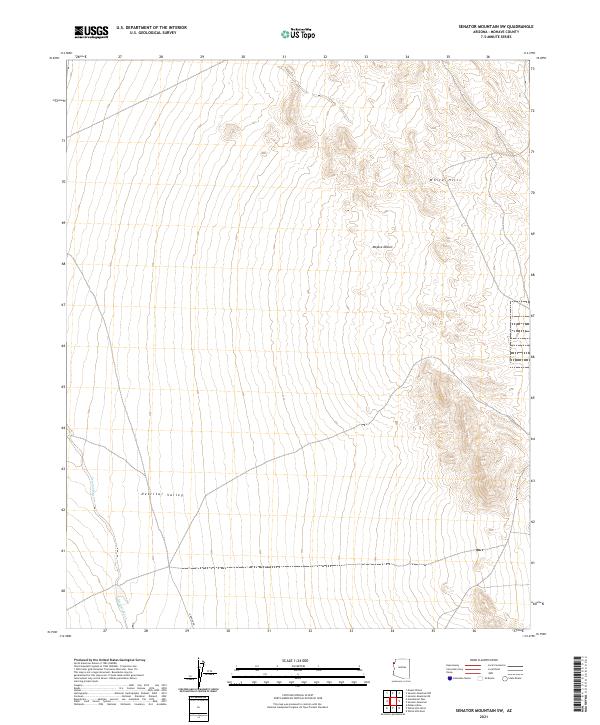
2021 Map of Senator Mountain SW
USGS Topo · Published 2021About this map
The Detrital Valley dominates this desert landscape, forming a broad structural trough between rising mountain ranges in northwestern Arizona. Situated within the eastern reaches of the Mojave Desert, the area is characterized by vast alluvial fans and the ephemeral drainage of Detrital Wash, which snakes through the western portion of the quadrangle. The elevation rises sharply in the northeast toward the White Hills, where the topography transitions from the flat valley floor to complex ridgelines. Aside from the remote corridor of Garden Rd, the map reveals a largely undeveloped expanse of public land defined by township and range survey lines. This 2021 update documents the contemporary drainage patterns and land management boundaries of this arid region, providing a clear view of the natural terrain before any potential future development.
Find a feature on this map
11 named features on this map. Tap any name to fly to it.
Don’t see what you’re looking for? This feature index may not catch every label — zoom into the map to look around manually.
Map Details
Editions of this 2021 Senator Mountain SW Map
This is the sole edition of this map. No revisions or reprints were ever made.
Other maps of this area

1886 · Camp Mohave
USGS Topo · 1:250,000

1892 · Camp Mohave
USGS Topo · 1:250,000

1926 · Nelson
USGS Topo · 1:96,000

1942 · Camp Mohave
USGS Topo · 1:250,000

1947 · Kingman
USGS Topo · 1:250,000

1948 · Kingman
USGS Topo · 1:250,000

1954 · Kingman
USGS Topo · 1:250,000

1955 · Kingman
USGS Topo · 1:250,000

1958 · Kingman
USGS Topo · 1:250,000
1959 · Mt. Perkins
USGS Topo · 1:62,500