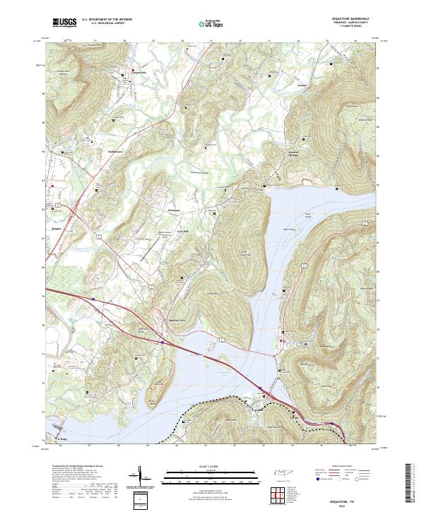
2022 Map of Sequatchie
USGS Topo · Published 2022About this map
Sequatchie Valley serves as the focal point of this Marion County survey, where the Little Sequatchie River meets the broader Tennessee River corridor. The geography is defined by the steep rise of the Cumberland Plateau to the west and Walden Ridge to the east, creating a narrow, high-relief landscape. The presence of Nickajack Lake and Guntersville Lake at the southern edge of the map indicates the significant impact of river management on the local topography, shaping landforms like Pryor Island and Oates Island.
Find a feature on this map
133 named features on this map. Tap any name to fly to it.
Don’t see what you’re looking for? This feature index may not catch every label — zoom into the map to look around manually.
Map Details
Editions of this 2022 Sequatchie Map
This is the sole edition of this map. No revisions or reprints were ever made.
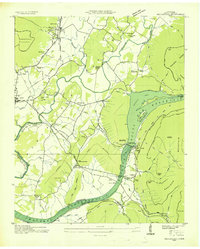
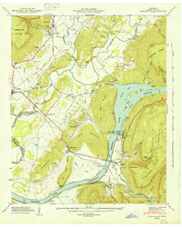
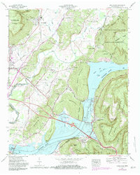
Historical Maps of Inman Through Time
5 maps found