
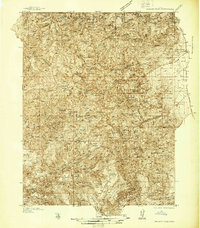
1932 Map of Sevier
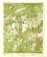
USGS Topo · Published 1975About this map
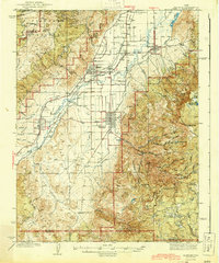
The Denver & Rio Grande Western railroad corridor anchors the eastern edge of this landscape, tracing the Sevier River valley through a region of high plateaus and deep drainage basins. Surveyed in the early 1930s, the terrain is marked by prominent high points such as Granddad Peak and Rockwood Peak, alongside distinctive formations like The Pyramids. The map documents a period when forest management and ranching were the primary human imprints on the land, evidenced by the Rockwood Ranger Sta and the Parker Ranch.
Find a feature on this map
113 named features on this map. Tap any name to fly to it.
Don’t see what you’re looking for? This feature index may not catch every label — zoom into the map to look around manually.
Map Details
Editions of this 1932 Sevier Map
This is the sole edition of this map. No revisions or reprints were ever made.
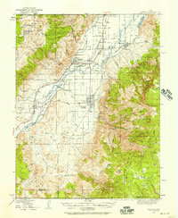
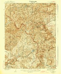
Other maps of this area

1885 · Beaver
USGS Topo · 1:250,000
1935 · Sevier
USGS Topo · 1:62,500
1937 · Delano Peak
USGS Topo · 1:48,000
1940 · Monroe
USGS Topo · 1:62,500
1943 · Delano Peak
USGS Topo · 1:62,500
1944 · Monroe
USGS Topo · 1:62,500
1945 · Marysvale
USGS Topo · 1:62,500
1947 · Marysvale
USGS Topo · 1:62,500

1953 · Richfield
USGS Topo · 1:250,000

1954 · Beaver NE
USGS Topo · 1:24,000