
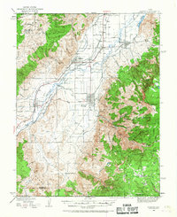
1940 Map of Monroe
USGS Topo · Published 1957About this map
The Sevier River valley serves as the central corridor for agriculture and transportation in this pre-war survey of central Utah. The Denver and Rio Grande Western Railroad tracks parallel the river, connecting the established communities of Monroe, Elsinore, and Annabella. While the valley floor is defined by a complex network of irrigation canals and settlements like Joseph and Nibley, the eastern landscape rises sharply toward the high elevations of Glenwood Mountain and Monroe Peak.
Find a feature on this map
62 named features on this map. Tap any name to fly to it.
Don’t see what you’re looking for? This feature index may not catch every label — zoom into the map to look around manually.
Map Details
Editions of this 1940 Monroe Map
2 editions found
Other maps of this area

1885 · Beaver
USGS Topo · 1:250,000

1885 · Fish Lake
USGS Topo · 1:250,000

1896 · Fish Lake
USGS Topo · 1:250,000

1932 · Sevier
USGS Topo · 1:62,500

1935 · Sevier
USGS Topo · 1:62,500

1937 · Delano Peak
USGS Topo · 1:48,000

1943 · Delano Peak
USGS Topo · 1:62,500

1944 · Monroe
USGS Topo · 1:62,500

1945 · Marysvale
USGS Topo · 1:62,500

1947 · Marysvale
USGS Topo · 1:62,500