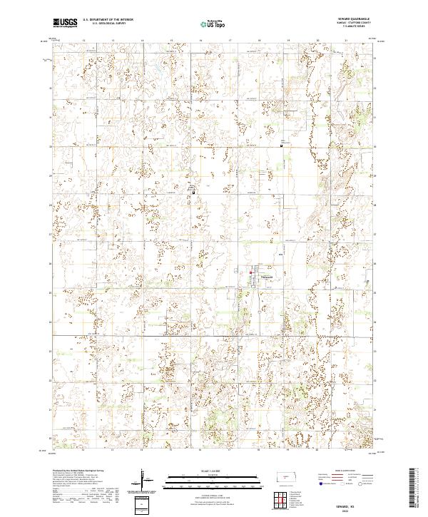
2022 Map of Seward
USGS Topo · Published 2022About this map
The small town of Seward serves as the central hub for this rural Stafford County landscape, where the flat plains are organized by a strict grid of section lines and gravel roads. In this farming-dominated region, historical continuity is found in sacred sites like the Eden Valley Cem and Saint Francis Xavier Cem, which are key landmarks for genealogists and local historians. The terrain is largely defined by intermittent drainage and depressions, with the thin line of Antelope Cr providing a rare break in the agricultural geometry of the northwest corner. Primary transport routes such as Larned Rd and Seward Rd connect the town to the surrounding townships, while a dense network of numbered avenues and streets like NW 20th Ave and NW 150th St divide the land into tidy parcels typical of the Kansas prairie.
Find a feature on this map
29 named features on this map. Tap any name to fly to it.
Don’t see what you’re looking for? This feature index may not catch every label — zoom into the map to look around manually.
Map Details
Editions of this 2022 Seward Map
This is the sole edition of this map. No revisions or reprints were ever made.
Other maps of this area

1891 · Great Bend
USGS Topo · 1:125,000

1893 · Great Bend
USGS Topo · 1:125,000

1955 · Great Bend
USGS Topo · 1:250,000

1957 · Great Bend
USGS Topo · 1:250,000

1957 · Ellinwood SW
USGS Topo · 1:24,000

1958 · Great Bend
USGS Topo · 1:250,000

1958 · Great Bend
USGS Topo · 1:24,000

1960 · Pawnee Rock
USGS Topo · 1:24,000
1969 · Radium
USGS Topo · 1:24,000
1970 · Hudson NW
USGS Topo · 1:24,000