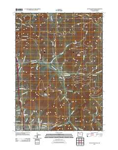
2011 Map of Sexton Mountain
USGS Topo · Published 2011About this map
Sexton Mountain and a series of prominent ridges define this Josephine County landscape in the early 21st century. The map centers on the small settlement of Lucky Queen, situated near the headwaters of Jack Creek. The topography is characterized by deep drainages like Shorthorn Gulch and Orofino Gulch, which feed into larger systems such as Jumpoff Joe Creek and Louse Creek.
Find a feature on this map
63 named features on this map. Tap any name to fly to it.
Don’t see what you’re looking for? This feature index may not catch every label — zoom into the map to look around manually.
Map Details
Editions of this 2011 Sexton Mountain Map
This is the sole edition of this map. No revisions or reprints were ever made.
Other maps of this area

1904 · Riddle
USGS Topo · 1:125,000

1908 · Grants Pass
USGS Topo · 1:125,000

1954 · Glendale
USGS Topo · 1:62,500

1954 · Gold Hill
USGS Topo · 1:62,500

1954 · Wimer
USGS Topo · 1:62,500

1954 · Grants Pass
USGS Topo · 1:62,500

1955 · Medford
USGS Topo · 1:250,000

1957 · Medford
USGS Topo · 1:250,000

1958 · Medford
USGS Topo · 1:250,000

1974 · Grants Pass NW
USGS Topo · 1:24,000