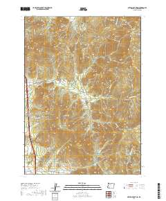
2020 Map of Sexton Mountain
USGS Topo · Published 2020About this map
Sexton Mtn dominates this Josephine County landscape, which is defined by a dense network of watercourses and ridges within the Siskiyou Mountains. The terrain is deeply incised by numerous drainages including Jumpoff Joe Cr, Shanks Cr, and Horse Cr, reflecting the region's complex topography. Historically significant transportation corridors are evident along the western edge, where Old Hwy 99 and Knights Xing trace the base of the foothills near Breakdown Cr. The presence of several named gulches, such as Orofino Gulch and Shorthorn Gulch, hints at the area's prospecting and ranching history. Forest management and access are documented through an extensive system of Bureau of Land Management roads, including BLM RD 34-6-13 and BLM RD 35-5-9, which weave through the high elevations of Walker Mtn and Roberts Mtn.
Find a feature on this map
71 named features on this map. Tap any name to fly to it.
Don’t see what you’re looking for? This feature index may not catch every label — zoom into the map to look around manually.
Map Details
Editions of this 2020 Sexton Mountain Map
This is the sole edition of this map. No revisions or reprints were ever made.
Other maps of this area

1904 · Riddle
USGS Topo · 1:125,000

1908 · Grants Pass
USGS Topo · 1:125,000

1954 · Glendale
USGS Topo · 1:62,500

1954 · Gold Hill
USGS Topo · 1:62,500

1954 · Wimer
USGS Topo · 1:62,500

1954 · Grants Pass
USGS Topo · 1:62,500

1955 · Medford
USGS Topo · 1:250,000

1957 · Medford
USGS Topo · 1:250,000

1958 · Medford
USGS Topo · 1:250,000

1974 · Grants Pass NW
USGS Topo · 1:24,000