2021 Map of Seymour
USGS Topo · Published 2021About this map
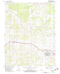
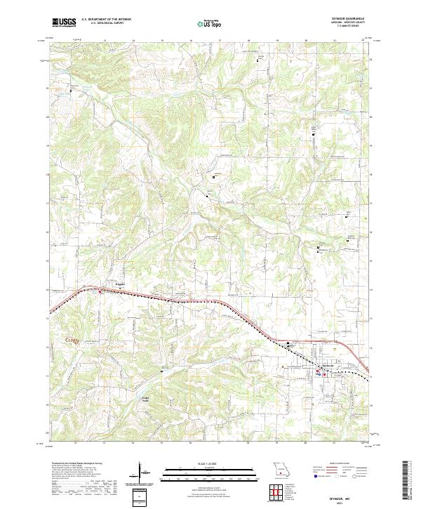
Seymour and Diggins anchor this contemporary 2021 study of Webster County, showcasing a landscape where the headwaters of the James River meet the undulating terrain of southwestern Missouri. The area is defined by its deep roots in local history, evidenced by a dense concentration of burial grounds including the Civil War Cem and Masonic Cem. The agricultural character of the region is reflected in a road network that includes Amish Loop Rd and numerous family-named routes. In the northern reaches, McCormack Spring and McElwain Spring feed into the river system, while several tributaries like Teague Cr and Little Finley Cr drain the surrounding hills. This survey provides a clear view of the modern rural infrastructure, from the school-centric School Box Ln to the corridors of State Highways A and O, providing a detailed base for genealogical research.
Find a feature on this map
102 named features on this map. Tap any name to fly to it.
Don’t see what you’re looking for? This feature index may not catch every label — zoom into the map to look around manually.
Map Details
Editions of this 2021 Seymour Map
This is the sole edition of this map. No revisions or reprints were ever made.