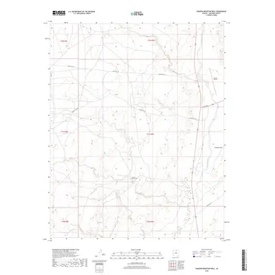
2018 Map of Shadow Mountain Well
USGS Topo · Published 2018About this map
Shadow Mountain Well serves as a central landmark in this arid portion of the Navajo Nation, where the terrain is defined by the ephemeral drainages of Hamblin Wash and Moenkopi Wash. This 2018 survey illustrates a landscape of high-desert connectivity, where the historic Navajo Trl and a network of Bureau of Indian Affairs roads, including Indian Rte 6134 and Indian Rte 6135, traverse the wide open plateaus of Coconino County. The southeastern corner of the quadrangle shows the approach to the Tuba City Airport, indicating the intersection of traditional routes and modern infrastructure. The map provides clear evidence of how water sources and transportation corridors dictated the utilization of this region, with the varied township and range boundaries of t31n r9e and t32n r9e overlaying the natural topography.
Find a feature on this map
15 named features on this map. Tap any name to fly to it.
Don’t see what you’re looking for? This feature index may not catch every label — zoom into the map to look around manually.
Map Details
Editions of this 2018 Shadow Mountain Well Map
This is the sole edition of this map. No revisions or reprints were ever made.
Other maps of this area

1886 · San Francisco Mtns
USGS Topo · 1:250,000

1886 · Echo Cliffs
USGS Topo · 1:250,000

1891 · San Francisco Mtns
USGS Topo · 1:250,000

1891 · Echo Cliffs
USGS Topo · 1:250,000

1894 · San Francisco Mtns
USGS Topo · 1:250,000

1899 · San Francisco Mtns
USGS Topo · 1:250,000

1947 · Flagstaff
USGS Topo · 1:250,000

1954 · Flagstaff
USGS Topo · 1:250,000

1955 · Coconino Pt NE
USGS Topo · 1:24,000

1955 · Blue Spring NE
USGS Topo · 1:24,000