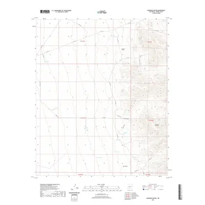
2020 Map of Shannon Canyon
USGS Topo · Published 2020About this map
The San Andres Mountains dominate the eastern reaches of this Sierra County landscape, giving way to a complex network of high-desert drainages and canyons. The terrain is defined by dry washes like Big Pitch Draw, Brushy Draw, and Waterhole Draw, which illustrate the arid hydrology of south-central New Mexico. Settlement here is sparse and focused on water management, evidenced by distributed infrastructure such as Hardin Tank, Middle Tank, and South Tanks. Named topographical features like Shannon Canyon and Well Canyon provide the primary landmarks for navigation through the township and range divisions. The map also traces local travel routes including Walker Loop and several county roads such as Co RD A-26, providing a record of the rural road network used for ranching and resource access.
Find a feature on this map
33 named features on this map. Tap any name to fly to it.
Don’t see what you’re looking for? This feature index may not catch every label — zoom into the map to look around manually.
Map Details
Editions of this 2020 Shannon Canyon Map
This is the sole edition of this map. No revisions or reprints were ever made.
Other maps of this area

1916 · Salinas Peak
USGS Topo · 1:125,000

1948 · Sowell
USGS Topo · 1:62,500

1948 · Malpais Well
USGS Topo · 1:62,500

1948 · Black Top Mountain
USGS Topo · 1:62,500

1948 · Salinas Peak
USGS Topo · 1:62,500

1954 · Tularosa
USGS Topo · 1:250,000

1958 · Tularosa
USGS Topo · 1:250,000

1981 · Big Gyp Mountain
USGS Topo · 1:24,000
1981 · Shannon Canyon
USGS Topo · 1:24,000
1981 · Polecat Tank
USGS Topo · 1:24,000