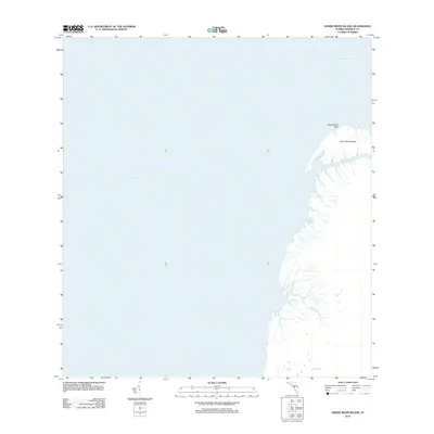
2012 Map of Shark River Island
USGS Topo · Published 2012About this map
Shark River Island sits at the intricate transition where the Florida coast meets the Gulf of Mexico, a landscape dominated by tidal hydrology and mangrove estuaries. This 2012 survey captures the coastal morphology of Monroe County, featuring the prominent Shark River Bluff and the winding reaches of the Little Shark River. The map documents a wilderness region defined by its watercourses rather than human infrastructure, showing the complex drainage of Big Sable Cr as it flows toward the open sea. This record is particularly valuable for tracking coastal erosion and the shifting boundaries of Ponce de Leon Bay, providing a precise benchmark for the environmental state of the Everglades' western fringe in the early 21st century.
Find a feature on this map
6 named features on this map. Tap any name to fly to it.
Don’t see what you’re looking for? This feature index may not catch every label — zoom into the map to look around manually.
Map Details
Editions of this 2012 Shark River Island Map
This is the sole edition of this map. No revisions or reprints were ever made.
Other maps of this area

1956 · Miami
USGS Topo · 1:250,000

1958 · Miami
USGS Topo · 1:250,000

1972 · Whitewater Bay West
USGS Topo · 1:24,000

1972 · Harney River
USGS Topo · 1:24,000

1972 · Lake Ingraham East
USGS Topo · 1:24,000
1972 · Lake Ingraham West
USGS Topo · 1:24,000

1972 · Shark River Island
USGS Topo · 1:24,000

1972 · Shark Point
USGS Topo · 1:24,000

1981 · Cape Sable
USGS Topo · 1:100,000

1988 · Miami
USGS Topo · 1:250,000