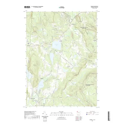
2021 Map of Sharon
USGS Topo · Published 2021About this map
Wononskopomuc Lake and Deep Lake anchor the central landscape of this Northwest Hills quadrangle, where the Litchfield County hills meet the New York state line. The village of Salisbury and the settlement of Lakeville sit along a network of historic roads, including Lime Rock Rd and Millerton Rd, which once connected these industrial and agricultural hamlets. The eastern portion of the map is defined by the high ridges of Sharon Mtn and Mt Prospect, where the Appalachian National Scenic Trail winds through the terrain. Evidence of the region's early settlements is found at Town Hill Cem and the Trinity Episcopal Cem near Lime Rock, while the town of Sharon remains a hub in the southwestern corner. Water bodies like Mudge Pond and Indian Lake highlight the recreational and natural character of the borderlands, with the Mudge Pond Town Beach serving as a local landmark.
Find a feature on this map
80 named features on this map. Tap any name to fly to it.
Don’t see what you’re looking for? This feature index may not catch every label — zoom into the map to look around manually.
Map Details
Editions of this 2021 Sharon Map
This is the sole edition of this map. No revisions or reprints were ever made.
Other maps of this area

1885 · Sheffield
USGS Topo · 1:62,500

1888 · Sheffield
USGS Topo · 1:62,500

1891 · Sheffield
USGS Topo · 1:62,500

1892 · Cornwall
USGS Topo · 1:62,500

1893 · Sheffield
USGS Topo · 1:62,500

1893 · Cornwall
USGS Topo · 1:62,500

1897 · Sheffield
USGS Topo · 1:62,500

1899 · Housatonic
USGS Topo · 1:125,000

1899 · Millbrook
USGS Topo · 1:62,500

1900 · Housatonic
USGS Topo · 1:125,000