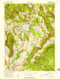
1956 Map of Sharon
USGS Topo · Published 1958About this map
Salisbury and Lakeville serve as central hubs in this mid-century topographic portrait of the Litchfield Hills, where the landscape is defined by its deep glacial lakes and iron-mining heritage. Industrial roots are evident at Ore Hill and the Garnett Prospect, while the village of Lime Rock sits along Salmon Creek, reflecting the area's long history of metalworking. Education is a prominent theme on this sheet, with the extensive grounds of The Hotchkiss Sch situated between Wononskopomuc Lake and Wononpakook Lake, joined by Salisbury Sch to the north and Indian Mtn Sch to the west.
Find a feature on this map
77 named features on this map. Tap any name to fly to it.
Don’t see what you’re looking for? This feature index may not catch every label — zoom into the map to look around manually.
Map Details
Editions of this 1956 Sharon Map
4 editions found
Other maps of this area

1885 · Sheffield
USGS Topo · 1:62,500

1888 · Sheffield
USGS Topo · 1:62,500

1891 · Sheffield
USGS Topo · 1:62,500

1892 · Cornwall
USGS Topo · 1:62,500

1893 · Sheffield
USGS Topo · 1:62,500

1893 · Cornwall
USGS Topo · 1:62,500

1897 · Sheffield
USGS Topo · 1:62,500

1899 · Housatonic
USGS Topo · 1:125,000

1899 · Millbrook
USGS Topo · 1:62,500

1900 · Housatonic
USGS Topo · 1:125,000