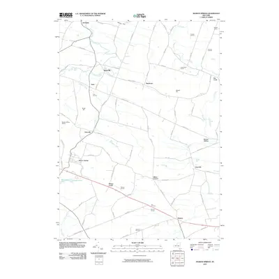
2010 Map of Sharon Springs
USGS Topo · Published 2010About this map
Sharon Springs sits as a prominent hub in this central New York landscape, where the terrain transitions through significant elevations like Maple Hill and Budd Hill. This 2010 survey illustrates a region defined by its small crossroads settlements and a network of named rural routes, including Old Tavern Rd and Latimer Hill Rd. The distribution of burial sites, such as Flanders Cemetery and Slate Hill Cemetery, alongside small rural airfields like Sharon Airport and Canajoharie Airport, reflects a community that maintains its historical footprints even while supporting local aviation. Waterways like Canajoharie Creek and Flat Creek drain the hills, shaping the placement of hamlets like Ames and Argusville. The area's character is fundamentally agricultural, with numerous small holdings linked by roads that often follow the natural contours of the hollows, most notably Browns Hollow in the eastern portion of the quadrangle.
Find a feature on this map
78 named features on this map. Tap any name to fly to it.
Don’t see what you’re looking for? This feature index may not catch every label — zoom into the map to look around manually.
Map Details
Editions of this 2010 Sharon Springs Map
This is the sole edition of this map. No revisions or reprints were ever made.
Other maps of this area

1896 · Fonda
USGS Topo · 1:62,500

1898 · Fonda
USGS Topo · 1:62,500

1898 · Canajoharie
USGS Topo · 1:62,500

1898 · Schoharie
USGS Topo · 1:62,500

1900 · Canajoharie
USGS Topo · 1:62,500

1900 · Schoharie
USGS Topo · 1:62,500

1902 · Canajoharie
USGS Topo · 1:62,500

1902 · Fonda
USGS Topo · 1:62,500

1904 · Richmondville
USGS Topo · 1:62,500

1943 · Cobleskill
USGS Topo · 1:24,000