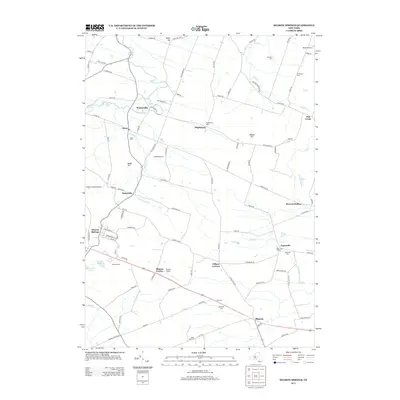
2013 Map of Sharon Springs
USGS Topo · Published 2013About this map
Sharon Springs anchor the southwest corner of this landscape, where the headwaters of Brimstone Cr and West Cr begin their descent through the rolling uplands. The area is defined by a network of small agricultural settlements and family-named homesteads such as Parsons Farm and Ridgedale Farm, connected by a web of rural roads that follow the contours of Wessel Hill and Budd Hill. This 2013 survey illustrates a quiet continuity of land use, where local heritage is preserved in numerous burial grounds like Slate Hill Cem and Bellinger Cem. To the east, Argusville sits along Flat Cr, a significant drainage that winds past Browns Hollow toward the northern boundary. The presence of several small airfields, including Sharon Airport and Russell Airport, suggests the importance of local aviation in this sprawling rural corridor between Waterville and Sharon.
Find a feature on this map
100 named features on this map. Tap any name to fly to it.
Don’t see what you’re looking for? This feature index may not catch every label — zoom into the map to look around manually.
Map Details
Editions of this 2013 Sharon Springs Map
This is the sole edition of this map. No revisions or reprints were ever made.
Other maps of this area

1896 · Fonda
USGS Topo · 1:62,500

1898 · Fonda
USGS Topo · 1:62,500

1898 · Canajoharie
USGS Topo · 1:62,500

1898 · Schoharie
USGS Topo · 1:62,500

1900 · Canajoharie
USGS Topo · 1:62,500

1900 · Schoharie
USGS Topo · 1:62,500

1902 · Canajoharie
USGS Topo · 1:62,500

1902 · Fonda
USGS Topo · 1:62,500

1904 · Richmondville
USGS Topo · 1:62,500

1943 · Cobleskill
USGS Topo · 1:24,000