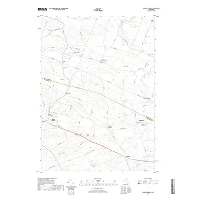
2019 Map of Sharon Springs
USGS Topo · Published 2019About this map
Sharon Springs and the surrounding dairy and farm country of the Montgomery and Schoharie border are documented here in detail. The terrain is defined by the transition from the Canajoharie Creek valley in the north to the higher elevations around Sharon Center and Sharon. Dozens of family-named roads and landmarks, such as Budd Hill and Wessel Hill, crisscross the landscape between established hamlets like Marshville, Ames, and Argusville. Local history is deeply embedded in the many rural burial grounds, including Olmstead Cem and Bellinger Cem, which sit alongside historic church sites like the Argusville Lutheran Church. The map also illustrates 21st-century infrastructure, including Russell Airport and Sharon Airport, placed among long-standing wetlands like Cedar Swamp and Bear Swamp.
Find a feature on this map
99 named features on this map. Tap any name to fly to it.
Don’t see what you’re looking for? This feature index may not catch every label — zoom into the map to look around manually.
Map Details
Editions of this 2019 Sharon Springs Map
This is the sole edition of this map. No revisions or reprints were ever made.
Other maps of this area

1896 · Fonda
USGS Topo · 1:62,500

1898 · Fonda
USGS Topo · 1:62,500

1898 · Canajoharie
USGS Topo · 1:62,500

1898 · Schoharie
USGS Topo · 1:62,500

1900 · Canajoharie
USGS Topo · 1:62,500

1900 · Schoharie
USGS Topo · 1:62,500

1902 · Canajoharie
USGS Topo · 1:62,500

1902 · Fonda
USGS Topo · 1:62,500

1904 · Richmondville
USGS Topo · 1:62,500

1943 · Cobleskill
USGS Topo · 1:24,000