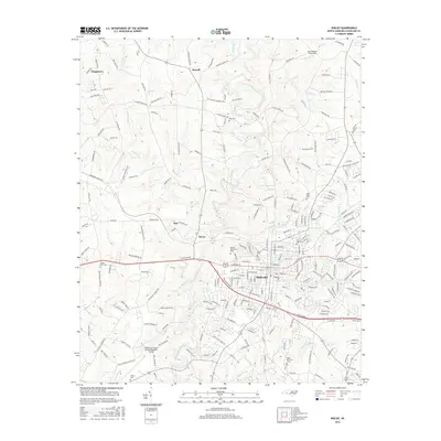
2016 Map of Shelby
USGS Topo · Published 2016About this map
The First Broad River carves a path through this Cleveland County landscape, anchoring the city of Shelby. The area's mid-2010s geography is defined by a dense network of suburban expansion and historical burial grounds, including Zion Cem, Ross Grove Cem, and Sunset Cem. Residential growth radiates from the city center toward smaller outlying settlements like Kingstown, Metcalf, and Ora.
Find a feature on this map
239 named features on this map. Tap any name to fly to it.
Don’t see what you’re looking for? This feature index may not catch every label — zoom into the map to look around manually.
Map Details
Editions of this 2016 Shelby Map
This is the sole edition of this map. No revisions or reprints were ever made.
Other maps of this area

1906 · Kings Mountain
USGS Topo · 1:62,500

1908 · Kings Mountain
USGS Topo · 1:62,500

1909 · Gaffney
USGS Topo · 1:62,500

1909 · Lincolnton
USGS Topo · 1:62,500

1911 · Lincolnton
USGS Topo · 1:62,500

1950 · Shelby
USGS Topo · 1:62,500

1953 · Charlotte
USGS Topo · 1:250,000

1954 · Charlotte
USGS Topo · 1:250,000

1960 · Charlotte
USGS Topo · 1:250,000

1962 · Charlotte
USGS Topo · 1:250,000