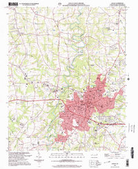
2002 Map of Shelby
USGS Topo · Published 2003About this map
Shelby serves as the focal point of this Cleveland County landscape, showing the city's residential and industrial footprint as it transitioned into the early 2000s. The First Broad River meanders through the center of the sheet, flanked by smaller settlements like Metcalf and Ora. Cultural and spiritual landmarks are densely packed throughout the area, including the Mulls Chapel Cem and Webb Memorial Lawns, alongside numerous community hubs such as the Twelve Oaks Academy and Royster Memorial Park. Evidence of mid-century leisure and infrastructure remains visible through the Drive-in Theater south of the city and the industrial presence of Industrial Waste Ponds to the east. The terrain is defined by the drainage patterns of Brushy Creek and Hickory Creek, illustrating how the local environment has shaped the growth of this North Carolina textile and agricultural center.
Find a feature on this map
64 named features on this map. Tap any name to fly to it.
Don’t see what you’re looking for? This feature index may not catch every label — zoom into the map to look around manually.
Map Details
Editions of this 2002 Shelby Map
This is the sole edition of this map. No revisions or reprints were ever made.
Other maps of this area

1906 · Kings Mountain
USGS Topo · 1:62,500

1908 · Kings Mountain
USGS Topo · 1:62,500

1909 · Gaffney
USGS Topo · 1:62,500

1909 · Lincolnton
USGS Topo · 1:62,500

1911 · Lincolnton
USGS Topo · 1:62,500

1950 · Shelby
USGS Topo · 1:62,500

1953 · Charlotte
USGS Topo · 1:250,000

1954 · Charlotte
USGS Topo · 1:250,000

1960 · Charlotte
USGS Topo · 1:250,000

1962 · Charlotte
USGS Topo · 1:250,000