2023 Map of Shelby
USGS Topo · Published 2023About this map
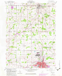
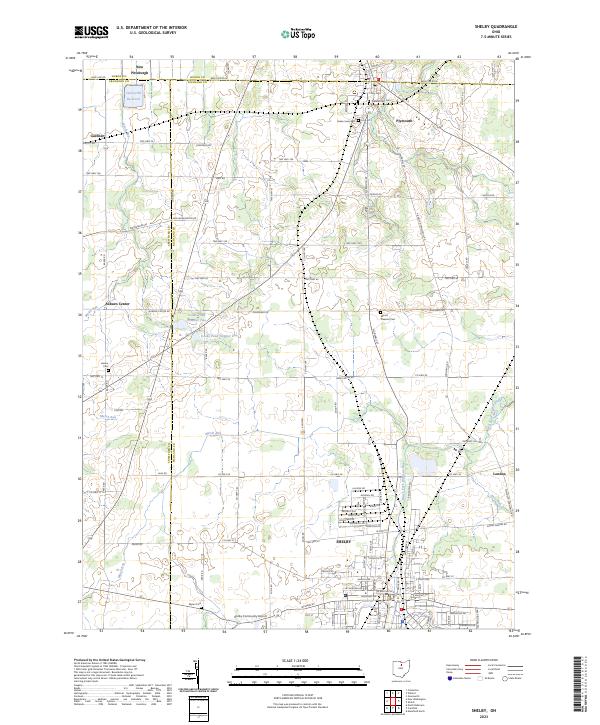
Shelby anchors the southern portion of this northern Ohio landscape, where the Black Fork Mohican River flows through the town's residential and industrial grid. This 2023 survey documents a region defined by its agricultural townships and the converging boundaries of Huron, Crawford, and Richland counties. Significant water features including the Celeryville Reservoir and the Cooke Pond system suggest a landscape managed for both utility and recreation. Smaller crossroads like Auburn Center and New Pittsburgh maintain their historical footprints amidst a dense network of county and township roads. Genealogists will find several notable burial sites preserved across the agricultural tracts, including Pioneer Rest Cem near Plymouth and the Mount Pleasant Cem further south. The presence of the Shelby Community Airport and the transition from the Marsh Run wetlands to the river valley illustrate the area's modern infrastructure layered over its established rural foundations.
Find a feature on this map
102 named features on this map. Tap any name to fly to it.
Don’t see what you’re looking for? This feature index may not catch every label — zoom into the map to look around manually.
Map Details
Editions of this 2023 Shelby Map
This is the sole edition of this map. No revisions or reprints were ever made.