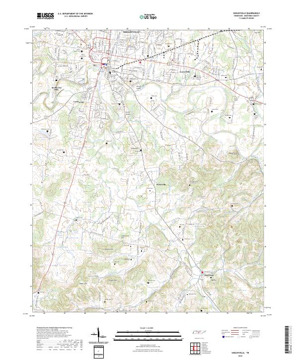
2022 Map of Shelbyville
USGS Topo · Published 2022About this map
Shelbyville serves as the central hub of this Bedford County landscape, where the Duck River loops around distinct landforms like Coney Island and Green Island. The settlement pattern extends from the urban core and the industrial Shelbyville Mills into outlying communities such as Creekwood, Forest Hills, and Himesville. For those researching local lineages, the map is remarkably dense with burial sites, including the prominent Willow Mount Cem and the remote Thomas S Word Cem.
Find a feature on this map
174 named features on this map. Tap any name to fly to it.
Don’t see what you’re looking for? This feature index may not catch every label — zoom into the map to look around manually.
Map Details
Editions of this 2022 Shelbyville Map
This is the sole edition of this map. No revisions or reprints were ever made.
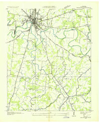
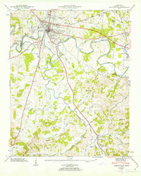
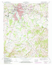
Historical Maps of Forest Hills Through Time
4 maps found