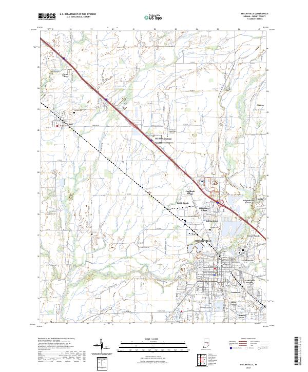
2022 Map of Shelbyville
USGS Topo · Published 2022About this map
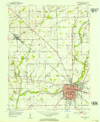
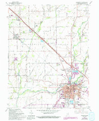
Shelbyville serves as the central hub of this Indiana landscape, where the Big Blue River and Little Blue River converge. The town grid is dense with neighborhood detail, extending from the historic core near the County Court House to residential developments like Walkerville and Wellington Heights. The surrounding countryside is defined by an intricate network of man-made drainage, including the William Clark Ditch and De Heur Ditch, which support the agricultural tracts between the city and smaller outlying settlements like Fairland and Marion. To the northwest, transportation corridors like N Michigan Rd and the frontage roads parallel the modern interstate path, cutting across the natural meandering of Brandywine Creek. Significant local history is preserved in numerous burial grounds, including the large Forest Hill Cem and the smaller Center Cem, marking the long-standing communities of Shelby County.
Find a feature on this map
63 named features on this map. Tap any name to fly to it.
Don’t see what you’re looking for? This feature index may not catch every label — zoom into the map to look around manually.
Map Details
Editions of this 2022 Shelbyville Map
This is the sole edition of this map. No revisions or reprints were ever made.
Historical Maps of Meiks Through Time
3 maps found