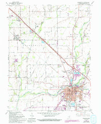
1962 Map of Shelbyville
USGS Topo · Published 1994About this map
Shelbyville serves as the focal point of this Shelby County study, situated at the confluence where the Big Blue River meets the local drainage systems of the Indiana plains. The mid-century urban core is detailed with civic landmarks like the Courthouse, Major Hospital, and the County Fairgrounds, while residential growth is evidenced by newer developments such as Lantana Estate and Wellington Heights. To the northwest, the village of Fairland remains a distinct community near the Conrail line, surrounded by agricultural tracts and the Swain Memorial Forest.
Find a feature on this map
73 named features on this map. Tap any name to fly to it.
Don’t see what you’re looking for? This feature index may not catch every label — zoom into the map to look around manually.
Map Details
Editions of this 1962 Shelbyville Map
4 editions found
Other maps of this area

1942 · Columbus
USGS Topo · 1:125,000

1948 · Lewis Creek
USGS Topo · 1:24,000

1948 · Marietta
USGS Topo · 1:24,000

1950 · Edinburg
USGS Topo · 1:62,500

1952 · Fountaintown
USGS Topo · 1:24,000

1953 · Shelbyville
USGS Topo · 1:24,000

1953 · Acton
USGS Topo · 1:24,000

1953 · Boggstown
USGS Topo · 1:24,000

1953 · Cincinnati
USGS Topo · 1:250,000

1956 · Morristown
USGS Topo · 1:24,000