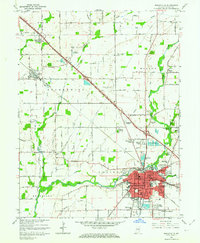
1962 Map of Shelbyville
USGS Topo · Published 1964About this map
Shelbyville serves as the busy urban hub of this 1962 survey, anchored by its Courthouse and the Major Hospital along the banks of the Big Blue River. The map reveals a post-war landscape in transition, where established neighborhoods like Walkerville meet newer residential developments such as Wellington Heights, Riley Village, and Candleglo Village. Rural life is still very much present, centered on landmark country churches like Old Union Ch and Brandywine Ch, alongside the Shelbyville Memorial Airport and the sprawling County Fairgrounds.
Find a feature on this map
71 named features on this map. Tap any name to fly to it.
Don’t see what you’re looking for? This feature index may not catch every label — zoom into the map to look around manually.
Map Details
Editions of this 1962 Shelbyville Map
4 editions found
Other maps of this area

1942 · Columbus
USGS Topo · 1:125,000

1948 · Lewis Creek
USGS Topo · 1:24,000

1948 · Marietta
USGS Topo · 1:24,000

1950 · Edinburg
USGS Topo · 1:62,500

1952 · Fountaintown
USGS Topo · 1:24,000

1953 · Shelbyville
USGS Topo · 1:24,000

1953 · Acton
USGS Topo · 1:24,000

1953 · Boggstown
USGS Topo · 1:24,000

1953 · Cincinnati
USGS Topo · 1:250,000

1956 · Morristown
USGS Topo · 1:24,000