
1956 Map of Morristown
USGS Topo · Published 1957About this map
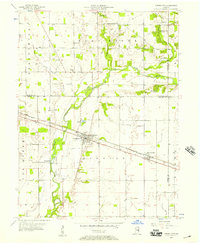
Big Blue River meanders through this mid-century landscape, defining the topography and border regions between Shelby, Hancock, and Rush Counties. The rail-oriented economy of the 1950s is anchored by the Baltimore and Ohio line, which connects the primary settlements of Morristown and Gwynneville. The community structure is clearly visible through numerous local landmarks, including the Township Sch and several family-named burial grounds like Asbury Cem and Davis Cem.
Find a feature on this map
35 named features on this map. Tap any name to fly to it.
Don’t see what you’re looking for? This feature index may not catch every label — zoom into the map to look around manually.
Map Details
Editions of this 1956 Morristown Map
2 editions found
Other maps of this area

1952 · Greenfield
USGS Topo · 1:24,000

1952 · Fountaintown
USGS Topo · 1:24,000

1953 · Shelbyville
USGS Topo · 1:24,000

1953 · Cincinnati
USGS Topo · 1:250,000

1956 · Cleveland
USGS Topo · 1:24,000

1956 · Rays Crossing
USGS Topo · 1:24,000

1957 · Cincinnati
USGS Topo · 1:250,000
1960 · Manilla
USGS Topo · 1:24,000
1960 · Carthage
USGS Topo · 1:24,000
1960 · Knightstown
USGS Topo · 1:24,000