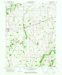
1960 Map of Manilla
USGS Topo · Published 1961About this map
Manilla and the surrounding townships of Walker and Posey anchor this landscape of the Indiana interior, where the Pennsylvania railroad cuts a straight diagonal across a terrain defined by complex drainage. Numerous ditches like Arbuckle Ditch and Hodge Ditch supplement the natural paths of Mud Creek and the Little Blue River, illustrating a managed agricultural environment. Local community life is evidenced by several rural centers of worship and education, including Big Flat Rock Ch and the Township Sch. A notable landmark, the Covered Bridge, spans the Flat Rock River near the settlement of Gowdy, marking a intersection of traditional infrastructure and modern resource extraction, as dozens of gas wells are scattered across the surrounding fields. Genealogists will find a high density of small family and community burial grounds, such as Hurst Cem, Sells Cem, and Green Cem, many located near these early farmstead sites.
Find a feature on this map
40 named features on this map. Tap any name to fly to it.
Don’t see what you’re looking for? This feature index may not catch every label — zoom into the map to look around manually.
Map Details
Editions of this 1960 Manilla Map
3 editions found
Other maps of this area

1942 · Columbus
USGS Topo · 1:125,000

1953 · Cincinnati
USGS Topo · 1:250,000

1956 · Morristown
USGS Topo · 1:24,000

1956 · Waldron
USGS Topo · 1:24,000

1956 · Rays Crossing
USGS Topo · 1:24,000

1957 · Cincinnati
USGS Topo · 1:250,000

1959 · Milroy
USGS Topo · 1:24,000

1959 · Rushville
USGS Topo · 1:24,000
1959 · Adams
USGS Topo · 1:24,000

1959 · Mays
USGS Topo · 1:24,000