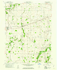
1960 Map of Manilla
USGS Topo · Published 1966About this map
The Pennsylvania railroad line cuts a diagonal path through this 1960 landscape of Rush County, connecting the grain and gas-producing hub of Manilla to the surrounding townships. This era in south-central Indiana is defined by a dense grid of rural infrastructure, where numerous gas wells are interspersed among established family landmarks like Sells Cem and Homer Cem. The drainage pattern is heavily modified by an extensive network of artificial channels, including Arbuckle Ditch and Goddard Ditch, which support the intensive agriculture between the natural flows of the Blue River and the Flatrock River. To the south, the community of Gowdy sits near the Big Flat Rock Ch, while a notable Covered Bridge spans the river nearby, marking a traditional crossing point in a region increasingly defined by industrial utility and early resource extraction.
Find a feature on this map
42 named features on this map. Tap any name to fly to it.
Don’t see what you’re looking for? This feature index may not catch every label — zoom into the map to look around manually.
Map Details
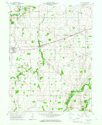
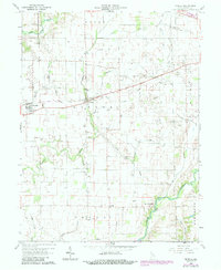
Editions of this 1960 Manilla Map
3 editions found
Other maps of this area

1942 · Columbus
USGS Topo · 1:125,000

1953 · Cincinnati
USGS Topo · 1:250,000

1956 · Morristown
USGS Topo · 1:24,000

1956 · Waldron
USGS Topo · 1:24,000

1956 · Rays Crossing
USGS Topo · 1:24,000

1957 · Cincinnati
USGS Topo · 1:250,000

1959 · Milroy
USGS Topo · 1:24,000

1959 · Rushville
USGS Topo · 1:24,000
1959 · Adams
USGS Topo · 1:24,000

1959 · Mays
USGS Topo · 1:24,000