
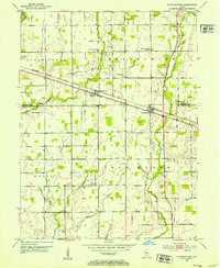
1952 Map of Fountaintown
USGS Topo · Published 1953About this map
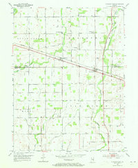
Fountaintown and Finly anchor this central Indiana landscape as it appeared in the early 1950s, defined by the steady transit of the Baltimore and Ohio railroad. The mapping reveals a rural social infrastructure centered on country churches and schools, such as the Brandywine Twp Sch No 1 and Little Sugar Creek Ch. The geography is intricately carved by an extensive drainage network, including Sugar Cr, Brandywine Creek, and numerous named ditches like Powers Ditch and Buck Ditch, which supported the region's agricultural productivity. Local history researchers will find significant genealogical value in the distribution of family-named burial grounds like Pelham Cem, Lisher Cem, and Ellis Cem, often situated near small crossroads like Fairview and Sexton. This survey documents the transition from steam-era rail stops like Reedville Sta to a modernizing road grid including 1100 N Rd and 800 N Rd.
Find a feature on this map
45 named features on this map. Tap any name to fly to it.
Don’t see what you’re looking for? This feature index may not catch every label — zoom into the map to look around manually.
Map Details
Editions of this 1952 Fountaintown Map
3 editions found
Other maps of this area

1952 · Cumberland
USGS Topo · 1:24,000

1952 · Greenfield
USGS Topo · 1:24,000

1953 · Shelbyville
USGS Topo · 1:24,000

1953 · Acton
USGS Topo · 1:24,000

1953 · Boggstown
USGS Topo · 1:24,000

1953 · Cincinnati
USGS Topo · 1:250,000

1956 · Cleveland
USGS Topo · 1:24,000

1956 · Morristown
USGS Topo · 1:24,000

1956 · Rays Crossing
USGS Topo · 1:24,000

1957 · Cincinnati
USGS Topo · 1:250,000