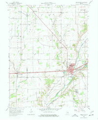
1960 Map of Knightstown
USGS Topo · Published 1961About this map
The Big Blue River corridor serves as the primary geographical anchor for this 1960 survey, where the historic National Road and the Pennsylvania railroad intersect at Knightstown. This regional hub, paired with the neighboring settlement of Raysville, reflects the classic Indiana pattern of small-town development along major transit arteries. To the west, Charlottesville straddles the county line, while the New York Central line cuts diagonally across the landscape toward Grant City.
Find a feature on this map
52 named features on this map. Tap any name to fly to it.
Don’t see what you’re looking for? This feature index may not catch every label — zoom into the map to look around manually.
Map Details
Editions of this 1960 Knightstown Map
Other maps of this area

1949 · New Castle West
USGS Topo · 1:24,000

1950 · Dunreith
USGS Topo · 1:24,000

1953 · Pendleton
USGS Topo · 1:24,000

1953 · Cincinnati
USGS Topo · 1:250,000

1956 · Cleveland
USGS Topo · 1:24,000

1956 · Morristown
USGS Topo · 1:24,000

1957 · Cincinnati
USGS Topo · 1:250,000

1959 · Mays
USGS Topo · 1:24,000

1960 · New Castle West
USGS Topo · 1:24,000
1960 · Carthage
USGS Topo · 1:24,000